The Winds of Mont Ventoux (2026)

Another epic summit, another day of rest. Today, we would drive to Lake Geneva, or Lac Leman in french. (Why can’t we all agree to call foreign places by their actual name. Like München instead of Munich?).

We drove toward the Swiss city of Geneva, but decided to avoid the big city traffic and hassle and experience a more casual pace of some smaller cities on the french coast of Lac Leman. Recently, the G7 held a conference in Evian-les-Bains so we decide to see what that was all about. Well, it was right on the shore of the lake and very nice indeed.

Evian les Bains. Home of Evain Water

The first thing we found out is that Evian-les-Bains is the corporate headquarters of Evian Water, the same bottled water you can buy in the USA. It is also a very picturesque city, We actually drove through the city and came to the border with Switzerland, but turned around. We just wanted to see what the border looked like, just like the Freemans did a few weeks ago.

Once we turned around, we found a Boulangerie in Evian-les-Bains and bought some sandwiches and ate lunch sitting on some benches along the lake and watched cormorants diving for their lunch too.

The next day, we would be driving south to Malaucène in the shadow of Mont Ventoux. Mont Ventoux is a ride that I did 7 years ago, but from Malaucène. Riding it from Bedoin was yet another of the rides that I had wanted to do 3 years ago, but did not do due to my medical condition. at the time. This would be the year, but I was nervous because of the reputation of the mighty mountain, not to mention the steep slopes. In 1967, Tom Simpson died riding this climb in the Tour de France. Of course, he was using amphetamines as a performance enhancing drug at the time and had a heart attack. I was counting on the fact that I was not using them!

As we were getting ready to depart the hotel in Grésy-sur-Aix, I noticed that two gentlemen in the hotel lobby were speaking english. Not just english, but American english (there is a distinct difference). I approached them and asked where they were from. They replied: Olympia, Washington! It turns out that they were in a band that had just played a concert in Aix-les-Bains the night before. Their band, Huldar is a Death Metal band and they were on a wild European tour. They were on their way to Marseilles that afternoon and then on to Germany. They definitely looked the part of a Death Metal band, but were very friendly and down to earth. It was nice to talk to some Washingtonians! Small world. One thing about our conversation. They had actually knew Kurt Cobain of Nirvana fame. One of the great hotel staff members, Guillaume was a huge Nirvana fan and was in awe that these men had actually know him.

After a drive of several hours, we arrived at our hotel later that afternoon, the Blueberry Hotel in Malaucène. The first thing we did was to drive over to Bedoin to see what that 12 km stretch of road looked like. We were contemplating riding from Malaucène to Bedoin as a warm up for our Mont Ventoux climb, but wanted to see what the road actually looked like and how much effort it would take to get there. There was a lot of steep climbing on the route so we decided it was going to be too much. We just ended up looking for a nice place to park to begin the ride the next morning.

The Blueberry was a nice place and had a restaurant as part of the hotel. We ate there and had pasta as part of our pre-ride carbo-loading regimen. I think we were going to need it. Mont Ventoux is a very hard ride. Epic, but hard!

Our ride started off with a flat warm up for a few kms, then pitched up and really never let up after that! The route went through a forested section before it opened up into the famous “moonscape” the you can see for 30 miles from below.
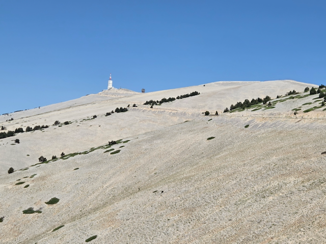
The Moonscape of Mont Ventoux. Still a ways to go!

One other thing about Mont Ventoux. Vent is the french word for Wind. And after we got out of the forested portion of the ride, the wind was blowing! It was a double edged sword…. A fierce headwind on parts of the road, followed by a major tailwind for other portions. The worst part was the transitions where the wind was sideways to the road and tried to blow us off the road into the ditch. Yikes! This happened more than a couple times, but I was able to stay on the road, bit just barely.

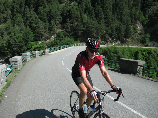
The approach to the top is maddening. You can see the giant tower on the summit from so far away that you think you are getting close, only to find out that there are many more switchbacks and many more kms yet to go. Maddening I say. But eventually, I did actually get to the top. Again, Steve was waiting for me at there, but I was still pleased to have finished.
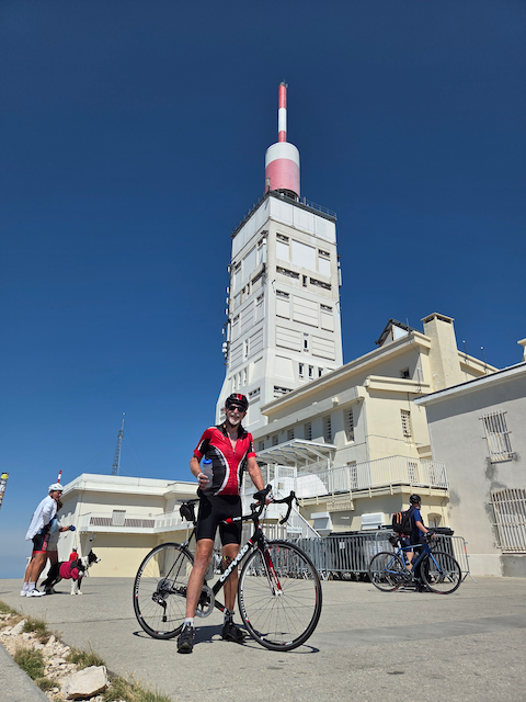
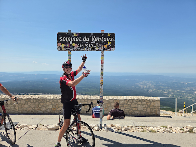
It seemed that each ride we did in France was harder than the last one. Mont Ventoux was indeed difficult, but now we would be on our way to Italy and the rides in Italy might be the hardest yet. Gulp!
Gran Fondo Marmotte (2026)

In a much needed rest and recovery day, Steve and I drove to Annecy for lunch and to show Steve some of the roads that I have been riding before he arrived in France. Tomorrow, we would ride the mighty Col du Galibier!

We drove out the same direction as we drove the other day, but drove past Saint Jean de Maurienne and continued on a few more kms to Saint Michel de Maurienne. From here, we would begin our ascent of the Galibier. The Col du Galibier is typically the highest point of the Tour de France on the years when it is included in the 21 day itinerary. And it was another ride I had wanted to do 3 years ago but was unable to, riding the Galibier from the Saint Michel de Maurienne side after having ridden from the other side 7 years ago.

On the drive to to Saint Michel de Maurienne, we noticed that there were a lot of cyclists out ridings on the way to the Galibier. We chalked it up to the fact that it was a Saturday and that the cycling clubs were out riding early in the morning to beat the expected heat that would certainly be present later in the day.

The ride begins with a nice warm up by riding up the Col de Télégraphe, a steep-ish 12 km precursor to the real crux of the day, the Col du Galibier, a true monster of a climb.

On the slopes of the Col de Télégraphe, it soon became evident that all of the riders we saw earlier were more than just club riders out on the road. We had stumbled into a major cycling event, The Gran Fondo Marmotte. Marmotte is the french word for marmot, the unofficial mascot of the Savoie. The Gran Fondo Marmotte turns out to be one of the most famous rides in Europe, and really in the world it turns out. It is a one or two day ride that 7-8000 riders cover the Col de Glandon, the Col de Telegraphe, the Col du Galibier, down to the Col de Lauteret, down valley to Bourg d’Oisans, and finishes at the top of the Alpe d’Huez….. a nice 16,000 ft day of climbing. And being out early, we were at the “head of the spear” so to speak, meaning that the riders we were seeing were the real fit riders actually racing up to the summit. Over the course of our ride, we are easily passed by over a thousand riders!

One real bonus for us being caught up in the middle of the Marmotte was that we were able to avail ourselves of the Marmotte water stations. There was no way the event organizers could keep tract of everyone wanting fill up their water bottles! We found this out at the summit of the Col de Télégraphe and would stop at several other water stations during the day.

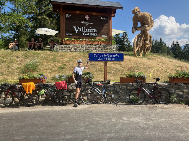
Steve at the Col de Télégraphe. A Nice Warm Up for the Day

From the Col de Télégraphe, we had a 4 km downhill, before an uphill to the town of Valloire. There was next a slight uphill grade before things got seriously steep.

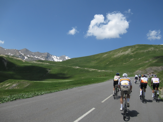
Riding Among the Riders in the Gran Fondo Marmotte

I was feeling pretty good on the ride up to the summit, but I knew that I was still a bit fatigued from the Croix de Fer, or at least aware that I might bonk again. I decided to ride with a measured effort. Steve was riding well ahead of me today and I insisted that he go ahead and ride at his own pace. It all worked out great and we both made it to the top, me about 5 minutes behind Steve, but still happy about the result. And we celebrated along with several hundred other riders who were at the summit at the same time as us.

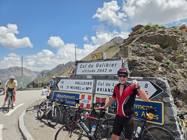
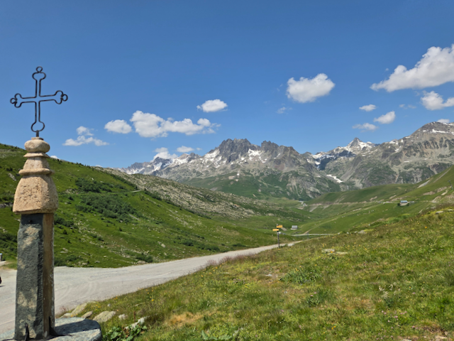
The Col du Galibier. An elevation of 2642 meters, or 8,665 feet

We got a good sense of how famous the Marmotte was at the top of the Galibier. We talked to a lot of riders from all over Europe. Germany, Spain, Italy, Great Britain, and even a guy from Philadelphia, PA. He and three friends flew over just for the weekend to try the Marmotte!

Being at the summit was pretty great, but we both noted that the descent was going to be tedious. While the riders doing the Marmotte were going to continue down the other side of the Col, Steve and I would be riding against the grain and have to dodge the several thousand riders still coming UP the mountain…. along with cars and motorcycles as well. This was not nearly as bad for me since I am a “white knuckle’ descender and very cautious, but Steve likes to let it go and is MUCH faster that I am. So he would really have to hold back.

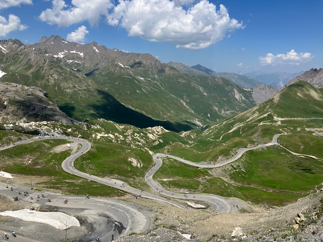
The Road lbelow the Col du Galibier. Thousands of Riders Still Riding Up

The descent was indeed tedious, but we thanked our lucky stars that the road was in good condition especially after the storm that was on the mountain just a few days ago. We slalomed downhill dodging everyone who was still coming up to the Col. It wasn’t until we started up the grade to the Col de Télégraphe the we finally got past the trailing riders of the Marmotte and had clear roads to our selves. The grade back up the Télégraphe was not too steep so we were able to climb back up without difficulty. From there, it was 12 km of downhill with some brand new pavement for the first 4-5 km. After the new pavement ended, Steve went flying past me. as I expected. But we ended up at the car within a few minutes of each other and set about finding a café for some post ride food., and a well deserved beer.

It was a really good ride; about 7,300 feet of climbing between the Col de Télégraphe and the Galibier. A true accomplishment for us, but paled in comparison to those who were riding the Gran Fondo Marmotte. But we were both good with it.

Conspiracy Theories (2026)

After our great ride up the Alpe d’Huez, Steve and I took a rest day and drove up to Chamonix…. because everyone needs to go see Chamonix!

We drove the slow, windy way through Megéve going up to Chamonix so Steve could see that part of France. Then, in Chamonix, we sought out the Rose du Pont restaurant where I had eaten before and it was just as good as the last time.

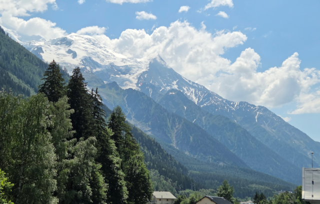
Another Stunning Day in Chamonix

With a days rest, we were ready for our ride up to the Col de la Croix de Fer. Steve rode this route up to the summit three years ago, but I was not able to ride. I had previously rode up to the summit from the other side, but wanted to attempt this route. I knew that it had some challenging grades, but was encouraged by our ride up the Alpe d’Huez two days ago.

We drove to Saint Jean de Maurienne and found a place to park on a side street, just a few blocks off the designated route to the summit. It was a little on the cooler side, but we knew it would warm up pretty quickly so we were anxious to get started.

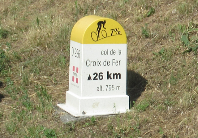
One of The Iconic Route Monuments found in the Savoie

The route we were riding was about 28 km and had significant elevation to climb to the summit. We were able to monitor our progress on the climb by reading the monuments that mark each kilometer of the climb. It lets you know how many kilometers to the summit, the grade the you will have for the next kilometer and the road number.

Everything was going well, but after about 8 km, I noticed that the route monuments suddenly changed to the Col de Toussuire. I did not mention it to Steve since we were following his GPS which he had on his bike and which we considered as gospel. But, after riding up the road, a while, Steve said he thought we were off route. We stopped on the side of the road and figured that indeed, we had missed a turn about 3 km down the road. We took the opportunity to catch our breath, drink some water and eat some food, then turned around and found where we erred. For ONCE, I got lost again, but it wasn’t my fault this time… a first!

Back on route, we rode up to a crest on the route where we rode through 3 short, well lit tunnels and then had a nice gentle downhill for a while. Then the rode flattened out for a while before gently starting back uphill. We took the opportunity to keep a decent pace but not over doing it, because we knew there were some steeper sections coming up soon. We rode through the village of Saint Jean -d’Arves while the grade was still fairly gentle. Next was Saint Sorlin- d’Arves and the road started to get steep again. These last 6 km was the section of the route that I was worried about because I had driven over this several times and knew it was steep. I still felt pretty good, but it was starting to wear on me and I could start to feel it in my legs.

On the Slopes of the Col de la Croix de Fer

With about 3 km to the summit, I finally bonked. Bonking is were you completely run out of energy and begin truly suffering! Yup, I bonked. The last 3 km were a real struggle for me, but being so close to the summit, I was not going to be denied and and finally got there with Steve waiting for me.

The Col de la Croix de Fer. The Iron Cross

With the hard part over with, I was able to recover a little with the downhill and started feeling better. That was good because we had two short uphills to negotiate on the way back to the car. The ride back up to the 3 tunnels was pretty easy and we were able to ride a pretty good pace using the big ring on the front derailleur. The next uphill was not as easy and I feel it in my quads for sure. But by then, we were only a few km from the car and this time, it really was ALL downhill from there.

Once back in Saint Jean de Maurienne, we found an open Boulangerie for lunch and had a good ham and cheese sandwich, the french classic Fromage et Jambon on Baguette! And a well deserved eclair too.

I was contemplating the ride while eating my lunch. I was not feeling really great about having bonked in the last 3 m of the ride. Then it hit me! Steve had led me up the Route of the Col de Toussuire… for almost exactly 3 km! of steep uphill. I am not sure how he knew that I was going to bonk at 3 km to go, but…. It was a conspiracy I tell you, a true conspiracy!

The Agony and the Ecstacy! (2026)

I traveled to Paris to meet up with Steve Barson. The summer solstice! And I got to ride the Bullet Train again.

Before I met Steve, I would need to get a hotel for the night since Steve wasn’t arriving until the next day. I got to Paris in the middle of the afternoon and walked to the hotel. It was about a 20 minute walk, and it was HOT! Paris set an all time record for the temperature that very day. 104F.

Once at the hotel, I needed to go find some dinner. There is no shortage of places to find food in Paris. But I noticed something. There was music EVERYWHERE! Almost every restaurant / café / bar had some outdoor music going on. Dinner was so enjoyable with all of this going on that afterwards, I just walked around this area of Paris just listening to all of the different music on the streets. And being the summer solstice, I stayed out almost til midnight. It wasn’t until the next day I found out that not only was it the summer solstice, but it was also France’s National Outdoor Music Day. I think the USA should have this too. Too much fun!

I had to do an errand in Paris before I would meet Steve. I mentioned that I tend to read a lot on these trips. Well, I had accumulated a lot of books that I had already read and I did not want to lug them around when I Iwould be leaving in a few weeks. So I wanted to go back to the Abbott English Bookstore that Lee and I had previously visited and donate the books that I had already read. Not wanting to take the metro, I walked to the bookstore. It was already hot at 10:00 in the morning and I was literally dripping with sweat by the time I got there. I donated the books to the store and bought a couple of new ones to tide me over for the next couple of weeks. Then I took the metro to the airport to meet Steve.

The rendezvous went smooth. Steve was cleared through Passport Control without any issues and then collected his bags and bike. We had to walk the entire length of Terminal 2 to get to the Hertz Rental car office, finally got our MG SUV and eventually got on our way to Chambéry. We didn’t get to our hotel until very late, but we had it all worked out with Julien to go straight to our rooms and get all of the check-in processing the next morning. It’s nice to know the Boss!

We got his bicycle put together the next morning and did a quick checkout ride to make sure everything survived the plane trip. It was just fine. So everything was all set to head over to Bourg d’Oisans the next day and try our luck on the Alpe d”Huez.

Alpe d”Huez is the most famous of all of the major cycling climbs in France. It might be the most famous climb in the world as far as I know since it is often featured in the Tour de France. Having been there a few other times, we knew right where to park. The weather was looking almost perfect. It was going to be hot again today, but it would be cooler up on the mountain and it was still pretty early. After a short 3 mile warm-up, we started up the Alpe. It is only a 14 km ride to the top (8.4 miles), but it basically is a steep ride the entire way, until the last few km’s.

The ride up went well, but for some reason, it was slower than the last time I did it 7 years ago. And I was using a lot smaller gears than the last time too. Something about getting older….

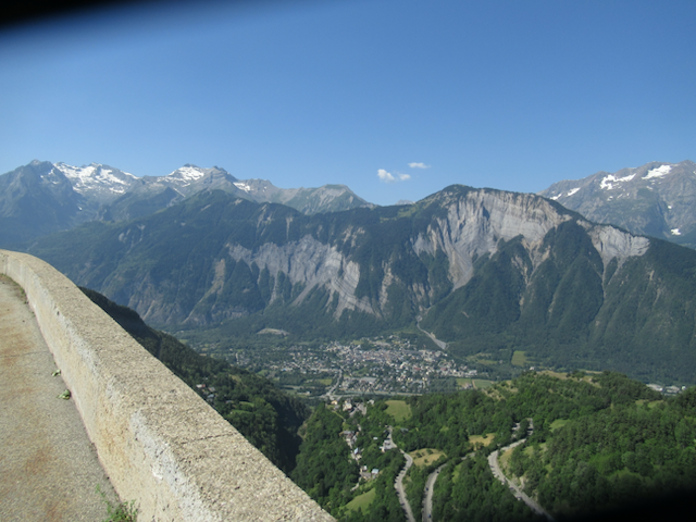
Looking Down on Bourg d”Oisans from The Alpe d”Huez and Some of the 21 Switchbacks

Steve and I were pretty happy with the ride when we got to the top. While we were up there, many other riders were finishing too. There was a group of riders all with the same jerseys so I told them all Congratulations on making it to the top. They were a bunch of Policemen, who just happened to be from Chambéry! Just as a coincidence, I had seen a rider in Chambéry recently who wore a jersey with “Chambéry” on it and it started me thinking that I would actually want to see if I could find one to buy. No luck anywhere, but these guys were wearing one so I asked it it was possible to buy one of their Chambéry Police Jerseys? They didn’t seem to take that very seriously, but they were friendly.

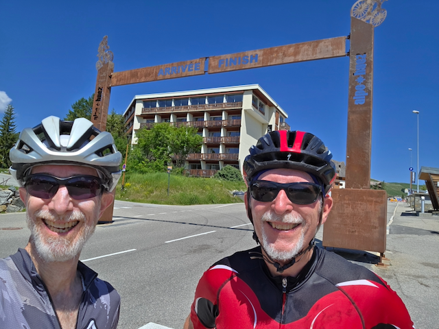
All Smiles at the Finish of the Alpe d”Huez Climb!

After descending the mountain and having a nice lunch in Bourg d’Oisans, I talked Steve into a detour driving back to Grésy-sur-Aix. We would drive up valley to the Col de Lauteret, and then over the Col de Galibier taking the long way back.

It was a long drive up to the Col de Lauteret. There were a lot of cyclists riding this route. It was not super steep, but we did not really have any interest in riding this ourselves for the simple reason that it had a few tunnels that looked pretty sketchy to us. Not lit up very well and NO shoulder. But it was a nice detour.

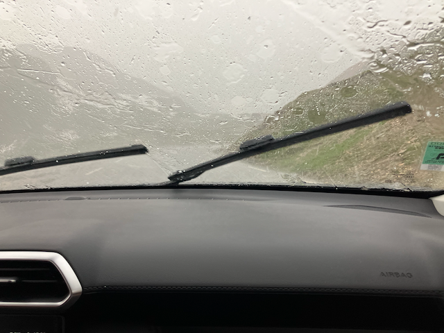
But the weather was starting to cloud up a little bit. And eventually we saw a few rain drops on the windshield. By the time we started driving up to the Col de Galibier, it was raining really hard with some hail mixed in. The many riders we saw were caught out in the middle of this mountain storm and basically had no place to hide. It was miserable for them.

Mountain Storm on the Galibier! From the Safe and Dry seat of Our Car.

It just goes to reinforce the axiom that the weather can change quickly in the mountains, whether you are in the Alpes or the mountains of the US. And to think that Steve and I had absolutely perfect weather just a few hours ago. And to find out the weather by the time we got back to the hotel was over 100 degrees….and no rain at all.

It was the Agony and Ecstasy. But not in that order. The Ecstasy for Steve and I on the Alpe d’Huez, and the Agony for everyone who got caught in the mountain storm on the Col de Galibier! Such is life for those on bicycles!

More Riding Until the Serious Rides Begin (2026)

With rides to Annecy, Mont Revard and a few fast, flat rides to Chambéry, I’m starting to find some riding form. Just in time!

Now, I just need to keep riding and maybe start to add some mileage to my rides. I have some ideas!

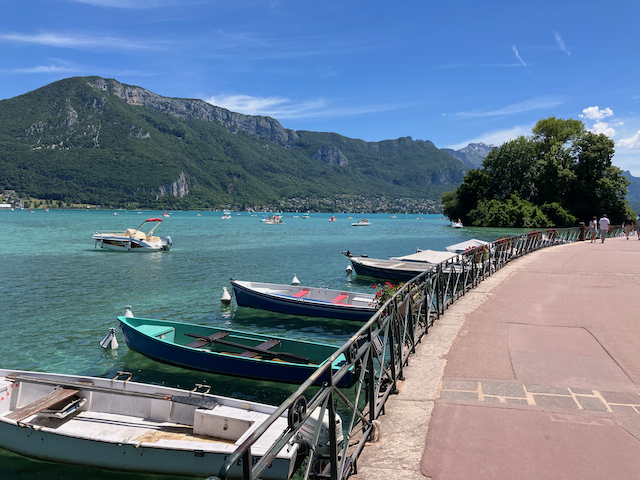
First, I really needed to get to Lac d”Annecy (Annecy Lake). I’ve basically been to Annecy twice now this trip, but have yet to actually see the lake. I finally can ride there and not take any wrong turns, so that will help. It is a little tricky it turns out to get to the lake. Annecy is such a tourist city that there is always a lot of pedestrian traffic and market vendors between the Rue de Trois Fontaines and the lake. Had to do some walking through the heavier traffic areas, but finally got to the lake.

The Beautiful Lac d”Annecy

Most of the lake has a nice bike and pedestrian path that is well used. Today was no exception. It was crowded enough that I did not want to weave through the people walking around the area. I just wanted to find a bench to sit down and drink some water and eat some food before heading back. Plus, the day was starting to heat up. We were still in the middle of the heatwave it turns out. And I made it back to the hotel and did not even get off route. Practice makes perfect!

I wanted to take another day off, so the next day, I decided to go to Chambéry and do some errands. And by errands, I mean going to the bookstore and buy some new books to read. It turns out that since most of the television is in french, I tend to read a lot of books when I am not riding. The Decitre bookstore in town has an English Books section!

In order to get to Chambéry and not be all sweaty from riding, I wanted to figure out some form of public transportation in order to get there. I think there is a bus system that could get me there, but I decided to figure out the regional train system instead.

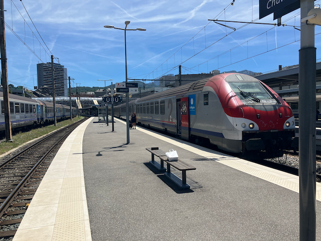
The Regional Trains. A simple, Convenient Way to Travel

The train station in Grésy-sur-Aix is only an 8 minute walk from the hotel . While it does not have much to offer in the way of customer service, it has a self serve ticketing system that was pretty easy to operate. A good thing too since when I say it did not have much for customer service, I actually mean none. The station is just a stopping point with no people who work there at all. But it was super convenient so this was going to be my public transpiration system of choice.

The train station in Chambéry did have customer service which was good. I would soon have to visit the ticketing office to make some reservations to get to Paris. This was how I was going to get to the Charles De Gaulle airport in Paris when I go to meet up with Steve. Also, the Chambéry train station had a pretty decent sandwich shop for lunch too. With a few new english language books in my backpack, I reversed the whole process and returned to the hotel. It turned out to be pretty easy.

Time to get another ride in. With todays ride, I would try to start trying to connect some of my previous rides into longer routes. I would attempt to link a ride out towards to Parc Regionall Naturel Massif des Bauges and then take a new route over to Annecy. The ride out to the parc was simple enough since I had ridden it often. I thought I would have to ride almost to Le Pont to take the road over to Lac d’Annecy, and then follow the bike path back to the Village of Annecy, and then back to the hotel. About 4 hours I estimated.

The road cutting over to Annecy was closer than I had remembered. It was a very beautiful road that was very pleasant to ride, and was very popular with other riders. But then, It popped out onto a very busy highway that did not go to the lake, but rather directly into town. This turned out to be a BAD decision to take that route, but I was able to get off the highway soon enough and then made my way back to Grésy-sur-Aix without any drama. But I would not be fooled by taking that route again. Nope!

The next ride would be another attempt to link previous rides into longer routes. Today, I would ride up to Trevignin, but instead of continuing on to Mont Revard, I would cut over toward Saint Félix via a road that first went through Le Montcel. I had never ridden this route, but I had previously seen a sign that I would follow. This is how I always manage to find trouble (and often get lost as well). The steep ride up to Trevignin went just fine, and actually, the ride over to Le Montcel was a nice ride as well. A very nice rural road with virtually no vehicle traffic. There was a nice sweeping descent down toward a village called Bassa and then the road over to Saint Félix. The road over to Saint Félix went through a very small village called Saint Ours. There was a VERY steep road leading to Saint Ours, but it wasn’t long.

Maybe I Shouldn’t Have Gone This Way! The Road to Saint Ours

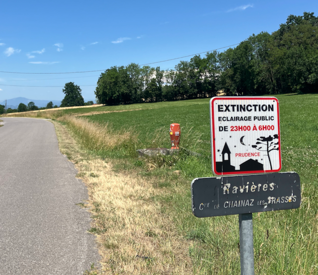
I did come across a new sign on the way. EXTINCTION! I was hoping the something was lost in translation. And there was. It turns out that the sign was indicating the the local street lights would be turned off 11:00 PM until 6:00 AM. Whew. The was close.

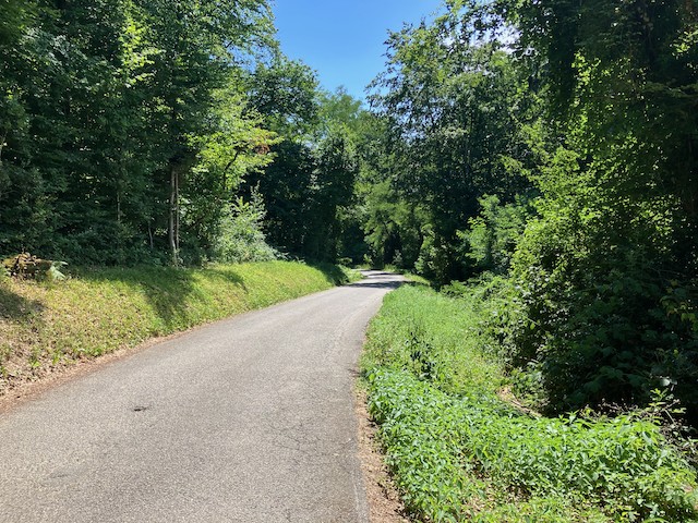
After not getting “Extinct”, I followed the road down to Saint Félix and found a very beautiful, narrow, deserted road that looked closer to a pathway than a road. But nice for cycling, for sure. The rest of the ride was simple since I had ridded so often with my previous rides to Annecy.

The roadway from Saint Ours to Saint Félix

Now, it was time to head to Paris. Some serious riding is just around the corner!

Mont Revard II (2026)

The easy way up Mont Revard went pretty well for me. That gave me some confidence to keep trying more difficult rides. Steve is only two weeks away!

I needed to try the ride to Annecy again, but this time with more fluids, food, and an earlier start so I could hopefully avoid the hottest part of the day. This time, I knew all of the correct roads to take so I wouldn’t be spinning my wheels and could get to Annecy in a timely manner. There is one hurdle left though. I had ridden to Annecy in the past and always got off route on the return, trying to navigate the roads out of the city. I studied the maps and had a pretty good plan for success, at least on paper.

The ride went well. Saint Félix, Rumilly, Annecy! I wanted to get to the lake, but the way to the lake was crowded with street vendors and large crowds, so I decide to just start back to Grésy-sur-Aix instead. I needed to find my way back to the Rue de Trios Fontaines. That was the key to getting to the route leaving the city. I found it , but not in a very straight forward way though. Kind of using dead reckoning and trying to move in the general direction where I thought it was. After that, no problem.

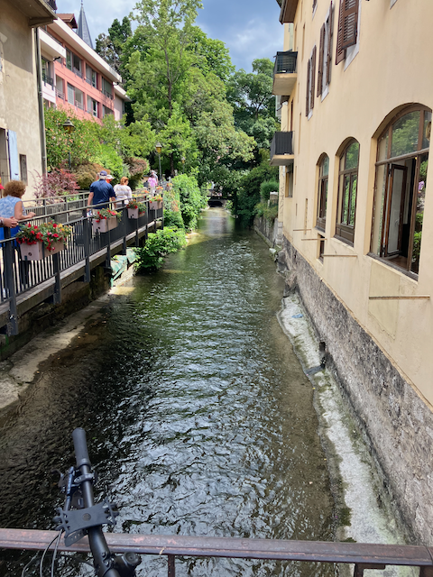
The outfall stream running through Annecy

After finding the Rue de Trois Fontaines, the rest of the ride was easy to find my way back. I had made a mental note when I went through Rumilly to note the turns to get to Saint Félix that I missed the last time. I think I now have this ride down now, as long as I can find the Rue de Trois Fontaines!

Now I’m ready to try the more difficult ride up to Mont Revard. It is 20km from the hotel to the top. 12.5 miles. The first 5km up to Trévignin was the hardest part. The last 2 km was only a slight incline. I came down through Plainpalais and down the way I came up the other day, to make a reverse loop.

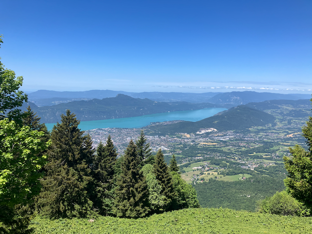
The View from Mont Revard- Aix-les-Bains and Lac du Bourget

The ride up this side of Mont Revard surprised me. You are riding through the forest until the last few km. Then things slightly open up and then you come up on several ski areas. I really had no idea there was skiing so close to Chambéry and the immediate area. Being summer, there were lots of people hiking, taking advantage of the cooler temperatures offered by the tree canopy and enjoying the trails through the forest.

After riding this more difficult route up Mont Revard, I am starting to think that I might survive the riding agenda that Steve and I have planned to tackle in a couple of weeks. Maybe….

Mont Revard (2026)

There are a few things I needed to do before my next significant ride.

First, I needed to do a short recovery ride. This would be to just go out and have an easy spin and loosen up my leg muscles. I’d try to kill two birds with one stone today. An easy ride out to Rumilly while figuring out all of the correct turns to make to get onto the correct roads for when I return to Annecy. I thought I would try to increase my odds of success by looking at some maps. So that ride went just great. Got it all figured out! Except for not exactly recognizing the correct turns to make for the ride back. I ended up on the wrong road back toward Saint Félix, but made a couple of turns and got back on route. Friends who know me and ride with me know this is not uncommon at all, for me to get off-route!

Next thing I wanted to do was to figure out how I might ride up Mont Revard. Mont Revard is a simple 4,000 foot climb to the top of a mountain that is right above Grésy-sur-Aix.

Mont Revard- A Nice 4,000 Foot Climb

There are multiple routes up Mont Revard. It is pretty straight forward, except for a section between Grésy-sur-Aix and the village of Trévignin. The route gets a little complicated with a maze of roads in this 5 km section (5 Km is about 3 miles if you don’t speak metric). Plus, it was a little on the steeper side so I decided to actually walk these 5 km up to the village of Trévignin, both to just get some exercise, and to judge the actual steepness of the roadway. It turns out that there is pretty good signage along the route to guide you to Trévignin. And while it had some steep sections, it wasn’t anything that was impossible.

So now, the only thing left to do was to actually ride it. I made my first ascent of it by riding the easiest route first. This route goes the long way around the mountain and comes up from the back side. Most of this route was familiar to me. I followed the route to the Col de Plainpalais via the Parc Naturel du Massif des Bauges, which I had ridden before. I did this three years ago when I had defied my doctors orders and rode to the top of this Col. From the Col, the route went up an easy grade for 9 km to the top of Mont Revard.

The Road to Mont Revard- 3 km to go

The grades were not extremely steep so not bad. From the top, I made a loop out of the ride and rode the 19 km down through Trévignin and then right into Grésy-sur-Aix. This way, I got to preview the route above Trévignin to the top. All in all, it was a pretty easy ride for a 4,000 foot climb. The grades were all reasonable but made for a longer ride to climb that much. It was a good start to get ready to ride the huge mountains of the Alps that were in my near future.

Icarus: Flying too Close to the Sun (2026)

With the Freemans now gone, and Steve Barson arriving in 3 weeks, I needed to get back on my bike. I hadn’t turned a single pedal stroke in 3 weeks and Steve might just kill me if I don’t regain some cycling form before he gets here.

But first of all, I had to see Julien, the Hotel Manager and my friend. He was away on holiday in Greece when I was here before. I should briefly mention that the Freemans and I had been staying in Chambéry the last couple days. The Freemans had made their reservations there before I found out that Julien did not manage the Budget Ibis Hotel there anymore and that he was now in Grésy-sur-Aix, about 10-15 miles away. The Freemans dropped me off at the B&B Hotel in Grésy-sur-Aix before they left for Paris. Anyway, Julien and I had a big reunion when we got there. It was great to see him again.

I had previously assembled my bike before the freemans had arrived in the 5 days that I preceded them. So I was all set. My first ride was just to ride up to this village named Cusy and then drop down into the Parc Naturel du Massif des Bauges, the equivalent of a State Park in the US. Not quite a National Park, but very scenic. I had previously ridden there in past visits to France so I knew the way. Since I hadn’t ridden in a few weeks, I thought that would be enough for the first ride. Especially since here was only a short, not very steep climb out of the bottom up to Cusy, then a nice downhill all the way back to the Hotel. It was a nice part to my training.

My next ride, I would try something a little more challenging. I would try to ride to Annecy, a very scenic touristy town that I had been to a few times before. Riding to Annecy from Chambéry was about a 90 mile ride and it was difficult the time I did that (once), but starting from Grésy-sur-Aix, it would be shorter, and easier, right?

I was pretty sure I knew all of the tricky parts of the ride getting to Annecy. Finding the right road from Saint Félix to Rumilly, finding my way through Rumilly to get on the correct road to Annecy, etc. Well, I did not get on the right road to Rumilly. I found my way onto a busier roadway that I had not remembered, so I had to deal with some traffic getting Rumilly which I did NOT enjoy, Then, it took me a while to get my bearing and get through Rumilly to the Rue des Annecy (the road to Annecy). All this took time, and it was starting to get hot, well I mean HOT (remember the heatwave?)

The road from Rumilly starts with a moderate uphill climb for about 30 minutes up to Marcellaz-Albanais, some rolling hills to Chavanod, then flat to Seynod, and finally a downhill to Annecy. I made it to Seynod! That was it. Too hot, not enough fluids, not enough calories. I stopped at a Boulangerie and had a coke and an eclair to get some fluids and calories, but there wasn’t much I could do about the heat.

The return ride was tough. And I still couldn’t find the right road from Rumilly to Saint Félix! I got on this road that was going in the approximate direction I wanted to go, but after a while, I didn’t have the slightest idea where I was or where I was going. About the time I was going to panic, I saw a road sign for Aix-les-Bains (which is next too Grésy-sur-Aix) so I started to feel better. I still wasn’t quite sure about where I was or how far I needed to go, but all of a sudden, I popped out in Grésy-sur-Aix. I made it. Whew! I spent the next 5 hours fighting off leg cramps and was generally miserable. I re-learned a valuable lessen today. More fluids, more calories.

The next day, I went to the sporting goods store and bought a lot of Cliff Bars and other nutritional bike food! I would not make that mistake again I hope. And I also figured out that part of my recovery for any longer ride was going to involve Beer! Ooh la la

The Last Leg of the Road Trip (2026)

Leaving Arles, we set out for Chambéry. I needed to show the Freemans my “home away from home”. Plus, they needed to drop me off since they would be taking the car back to Paris in a couple days so I needed to get back to Chambéry, of course!

We arrived in town pretty early, early enough for lunch. After lunch, we just walked around the old village of Chambéry, looking at the shops and trying to find shade since we were still having the heatwave. We got a sense of what the village was like, but many of the shops were closed since it was a Monday and that is the culture of France, that many businesses are closed on Sunday and Monday after being open on Saturday (and maybe part of Sunday). We did manage to find an outdoor restaurant/bar that served Belgian style ales, so we had to stop (or rather I had to stop).

The next day, we headed for the mountains. Everyone needs to see Chamonix and that is exactly where we went, Chamonix in the shadow of Mont Blanc. And this is what I told the Freemans… that they needed to see Chamonix. I think they were a little bit skeptical of my enthusiasm.

We drove the route that goes through Megève which is a twisty, curvy road. It is a slow drive with the windy roads and slow moving traffic along the way. But it is French ski country, so it was scenic. Eventually, we arrived in Chamonix, but I convinced them that we should keep driving up valley toward the border with Switzerland. We did stop at one of the small villages along the way to get something to tide us over until lunch later in the day. We drove up to a small pass and had a short downhill drive until we came to the Swiss border. Technically, we were not allowed to drive the rent-a-car across any borders, so I parked the car in a wide spot in the road and let Lee, Mary, and Nicole walk across the border so they could brag that they went to Switzerland too. They didn’t do much except to say they went there.

The Views Up Valley from Chamonix

Returning to Chamonix, we found one of the main tourist areas which consisted of carless streets with restaurants and shops of all kinds. One of the shops was a sun glasses shop which happened to sell Ray Ban’s. And it just happened that I had a pair of Ray Ban’s that had lost a screw on one of the frame bows (which Lee did a total MacGyver temporary fix). I asked if they had a proper screw to repair them and they said to leave them and come back in 20 minutes. That was just enough time to stroll along the tourist streets and see what Chamonix had to offer. After 20 minutes, we returned to the sun glasses place and they indeed had my glasses repaired. At no cost even. Who said the French were rude!

The Arve River Flowing Through Chamonix

Time for lunch! There were a lot of choices in Chamonix as you would expect. We chose the Rose Du Pont which turned out to be an excellent choice. It was right next to the Arve River which flows right through the village. It was pretty early in the year, so the river was flowing pretty fast. We saw a few rafts go by as we ate as a matter of fact. During lunch, I think we all agreed that everyone needs to see Chamonix! and they certainly were glad they did.

Well, it was all over but the shouting as they say. We drove back to Chambéry, had dinner and went to the hotel in Chambéry for one last night. Lee, Mary, and Nicole would be leaving in the morning and I would be on my own for a while.

I think we accomplished a lot on our France Road Trip. We saw some of the most well known sights in France, and a few that were off the beaten path (which is always fun). I think the Freemans enjoyed it. I know I did, and it is aways good to see my great friends, especially on an epic vacation!

Pont du Gard and Arles (2026)

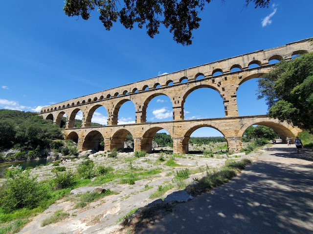
The next stop on our whirl-wind trip around France as to visit the Famous Pont du Gard. The Pont du Gard is an ancient Roman Aqueduct built by their engineers around 2000 years ago. I visited it 3 years ago, but it is worth another visit, especially since Lee is an engineer and would appreciate seeing it. I think Mary and Nicole will enjoy it as well. The biggest reason why we wouldn’t is because it is still blazing hot each afternoon with the current heatwave!

Pont du Gard- The Famous Roman Aquaduct

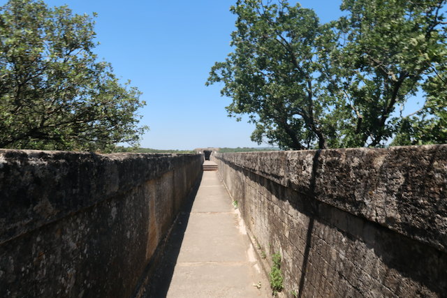
The Pont du Gard crosses over the Gard River and was constructed to provide water to the Roman city of Nîmes. The aqueduct structure is built with several tiers, but the water was carried at the very top tier for engineering reasons.

As part of our visit to the aqueduct, we visited the museum and learned a lot more about it than I had previously known. The Pont du Gard was only one of many structures built as a part of an entire conveyance system to carry water to Nîmes. There are remnants of the rest of the system, but they are not in very good condition and in some instances, not even recognizable anymore. The roman engineers of 2000 years ago had many challenges to this project, mostly that the grade of the channel was very slight and required very precise construction to have any chance of getting the water to flow to Nîmes. The upper channel of the Pont du Gard was even raised slightly after the construction was finished to improve this flow rate.

The Water Channel at the Top of the Pond du Gard

But even with this modification, the entire system was only operated for 150 years before it was abandoned because of low flows and the resulting high maintenance. When you view the aqueduct today, you notice that one of the ends of the structure seem to be in disrepair. This is because after the water conveyance system was abandoned, the romans began repurposing much of the stone work for other projects. The aqueduct was partially dismantled for this reason. So, as wondrous as the Pont du Gard is to see today, it was considered a failed project in the long run.

After visiting the aqueduct and accompanying museum, we set out for Arles where we had plans to stay. It wasn’t a long drive from the aqueduct, at least in theory. We used our modern technology to guide us to our destination, GPS. We followed the directions the GPS was instructing us to follow, but as we got to town, the directions were guiding us into smaller and smaller streets, and then into small alleys until we reached our destination….. Which wasn’t our planned destination at all. It seemed that we had arrived at the correct address, but not the correct town! And to make matters worse, we were wedged in pretty tight in the alley we were in. And the way forward was blocked by bollards, steel poles set in the ground to prevent cars from entering the alley from the opposite way we came from. The prospect of backing out of the alleys and streets was not very promising, but we were going to have to try it though. What choice did we have?

Just as a wild notion, I got out of our car and went to see if there was any way around the bollards, but the openings were just too narrow for the car. So I did the next best thing. I checked to see if the bollards could be removed by just pulling them out of the ground. And they were! We were simply able to pull them out of their post holes and drive right into a parking area and then exited into the adjacent street. Whew!

I think we ended up in Beaucaire, but I’m not completely sure. But it looked nice a nice town and had a nice restaurants and shops that looked inviting, but we had to backtrack and find our way back to Arles.

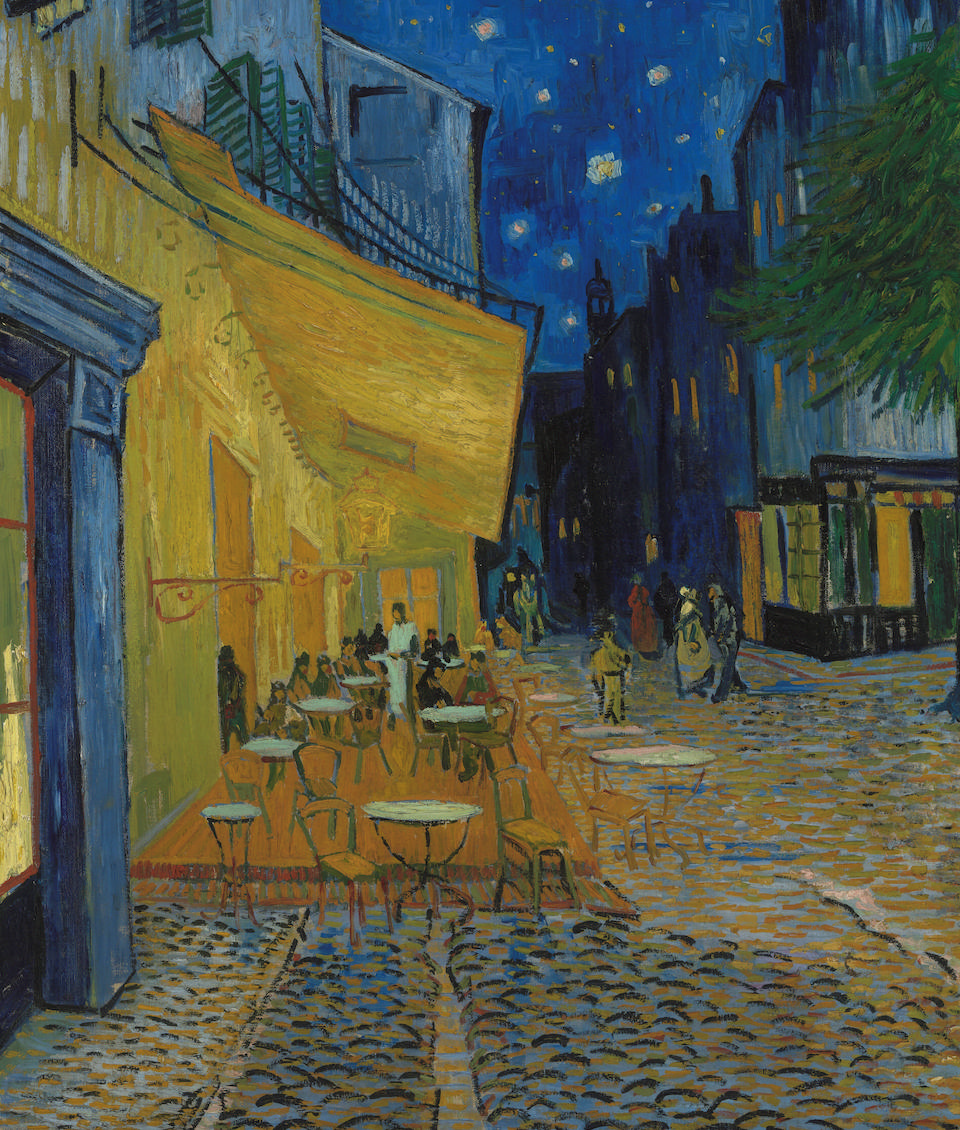
Once in Arles (finally), we easily found our real Hotel where we had our reservation. It was right on the Rhone River, the large part of the river with large river cruise boats lining the river banks. But there were not any river side restaurants nearby so we went into the old town and found a nice area with lots of places to choose from to eat. Afterwards, we strolled around the town and saw the ancient Roman coliseum that was built there. But one other thing I wanted to see was the place where Vincent Van Gogh painted one of his most famous paintings, The Café Terrace at Night.

The Café Terrace at Night by Vincent Van Gogh

Supposedly, the existing café was recreated to look like the painting, but once we found it, the location looked run down and not anything close to what the painting looked like. But now I know! The silver lining was that we found a section of Arles that looked very upscale with lots of nice restaurants. A place to consider the next time we are in Arles, for sure.